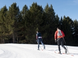
If you like cross-country skiing you can get to know Austria, one of the most spectacular countries with hundreds of corners to know and in which to practice winter sports. We show you corners that you can access and enjoy an unforgettable experience.
Glockner contains Austria's highest peak: Gossglockner (3,797 m). The Venediger group has another of the highest peaks, Gross Venediger (3,674 m), and is one of the Austrian massifs with the most interest for mountain skiing due to the good inclination of its slopes. .

Although the itinerary runs avoiding the crevasses of the glaciers, you must pay attention to them, even in good weather. An average mountain skier can complete the proposed route in three days, ascending to the highest peak of the massif with a final descent of more than 2,300 m of elevation gain, which will take us from the eternal snow to an Austrian valley. However, the variants to this itinerary are many and exhausting the possibilities of the Hohe Tauern is an almost impossible task. We recommend that you do the routes between March and April.
Starting point
Prägraten (about 1,500 km from the La Jonquera border). Prägraten can be reached via Innsbruck (via Switzerland) or Bolzano (Italy). The closest airports are Innsbruck, Bolzano or Salzburg.
First stage. Prägraten- Streden (1,403 m)- Essener Rostocker Hütte (2,208 m). Elevation: about 810 m.
From Prägraten, drive 4 km on a paved road to Streden, from where, with skis on our feet, we ascend the Maurer Valley. At 1,552 m we will find the lower station of the cable car, which supplies the refuge and also usually carries the backpacks of those who spend the night there. We climb the left orographic slope, leaving the ravine on the left until we reach the end of the cable car, where we find the refuge.
Variant. The refuge is the base for ascents to the nearby Rostock Eck. (2,749 m) or to the more distant Westl. or Ostl. Simony Spitze (both ends 3,488 m), or the Malham Spitze.

Second stage. Essener Rostocker Hütte (2,208 m) - Maurer Törl (3,108 m) - Kursinger Hütte (2,562 m). Elevation: in total 1,070 m (900 m to the hill plus 170 m to the refuge).
From the refuge you ascend following the bottom of the valley that opens to the north to the Maurer Törl pass. We descend through the Obersulzbach Kees to the elevation 2,350 m, from where we will observe the refuge, located in a dominant position over the glacier ice.
To reach the refuge, you can ascend along the SW slope, near the summer path, or, if there is no snow, ascend in the direction of the Zwischensulzbachtörl to an elevation of 2,550 m, climb up the moraine to a small hill (elevation 2,620) and from there descend to the refuge.
Variant.It would be a shame to pass so close to the Grosser Geiger (3,360 m) without climbing it; For this purpose, part of the weight of the backpacks can be left towards the 2,800 level. Another possibility is to descend the west col of Grosser Geiger. This hill is more delicate and may require the use of a rope.
Third stage. Kursinger Hütte (2,562 m) - Gröss Venediger (3,674 m) - Hinterbichl (1,340 m). Elevation difference: 1,130 m (870 m without ascending the Gross Venediger).

From the refuge, we climbed to the level of 2,620 m (the small hill of the second possibility of the previous day's stage) and from there we followed a descending journey to reach Obersulzbach Kees. From there we ascend the glacier to the Venedigerscharte (3,413 m), which is the pass between the Klein (small) and the Gross Venediger.
Next, we follow the southern slope of the east ridge of the Gross Venediger and flank it to reach the large cross that marks the summit, although when we made the ascent the accumulation of snow left the cross below the climax point .
Then you descend in the direction of the Defreggerhaus (2,962 m) and continue the descent through the Dorfer torrent, the Johannis Hütte (2,121 m) to Hinterbichl. And since 2300 m of descent is not done every day, it may be a good idea to stop and enjoy it at one of these two refuges. Attention, you need to make sure they are open beforehand!

Variants. In addition to the obvious one of climbing from the Venedigerscharte pass to the Klein Venediger (nor is it higher than the Aneto every day for less than 70 m in elevation), the refuge of the Drefeggerhaus (haus in German means house) is an excellent base for climbing some of the many in the area, such as the Hoher Zaun or the Weiss Spitze.